Can’t stop thinking about being out walking but are following the rules and staying home?
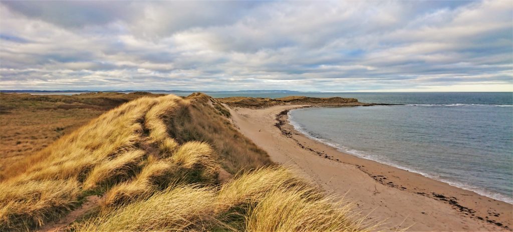
Obviously, if you are self isolating or just staying home like you’ve been told, you can’t walk far. Just from the sofa to the kettle and back again and maybe varying it a little with a hill walk to the upstairs lavatory. Everyone has favourite walks that they repeat many times but this is taking it a bit too far.
We all need to keep ourselves busy until we can safely venture out again. I’ve learned a bit about keeping busy recently. I got a cough about a week before we all got told to stay home, so not being able to know whether its a cold, flu or a mild case of CoViD19, I had no choice but to stay in the house and wait for it to go away. So, to fill the time between “Homes under the Hammer” and “Pointless”, I decided to plan where to go after this is all over with.
I started looking for new places to go and planning walks around them. As well as this I did a bit of research about the walk to see if there is anything interesting close by and there usually is. This post is about what I used to do this without going out to recce the walk and maybe trying these online tools might entertain you for a while.
Maps
I like maps and this is a perfect time to indulge that interest. You don’t need paper maps for this and you don’t need expensive software or licences. I have plenty of paper maps and online OS maps but there are plenty of free tools available that I use regularly. The tools that I use and what I use them for are listed below.
Google Maps
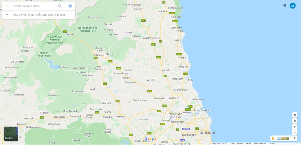
Google Maps is widely used for finding places and directions but it can be an essential tool for the walk planner. There is no OS mapping included, so it’s not as good as other mapping to plan walks. However, there are some great features that I use regularly, aerial view and street view.
Aerial view
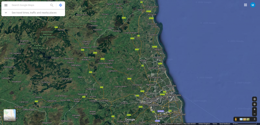
The aerial view is an alternative to the Bing version. I find that using aerial view really helps in figuring out what the terrain is really like. It also gives you an idea of whether river crossings marked on maps are actually usable and what kind of animals are usually in a field. Take care here though as aerial photos can be out of date.
Street view
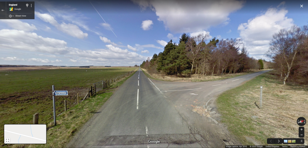
The Street View feature allows me to actually take a look at the roads close to where I will walk. This can let me see signage and whether there are gates or stiles at certain points. It can also allow me to assess parking available without needing to go there.
Bing Maps
Bing Maps is an online mapping website like Google Maps. However, Bing Maps has OS Maps included, which is why it’s one of my favourites. I haven’t found a way of making it work on mobile platforms yet though. It has great mapping, aerial view and Streetside, which is similar to Google Street View but with less coverage. I use the maps and aerial view.

Maps
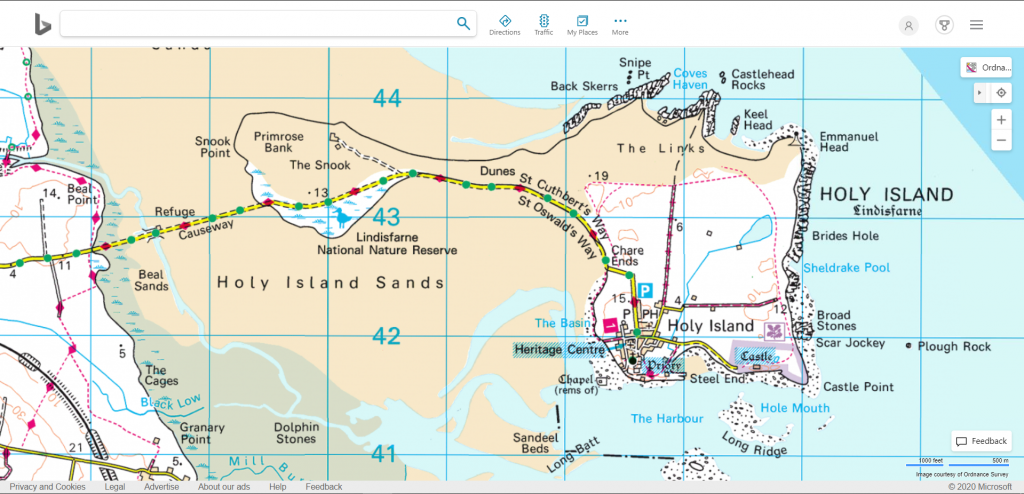
The key thing about Bing Maps is that it incorporates OS Maps. Theres a little menu at the top right of the map screen, where you can select what you want. Both 1:50,000 and 1:25,000 are included and activate on the level of zoom.
Aerial view
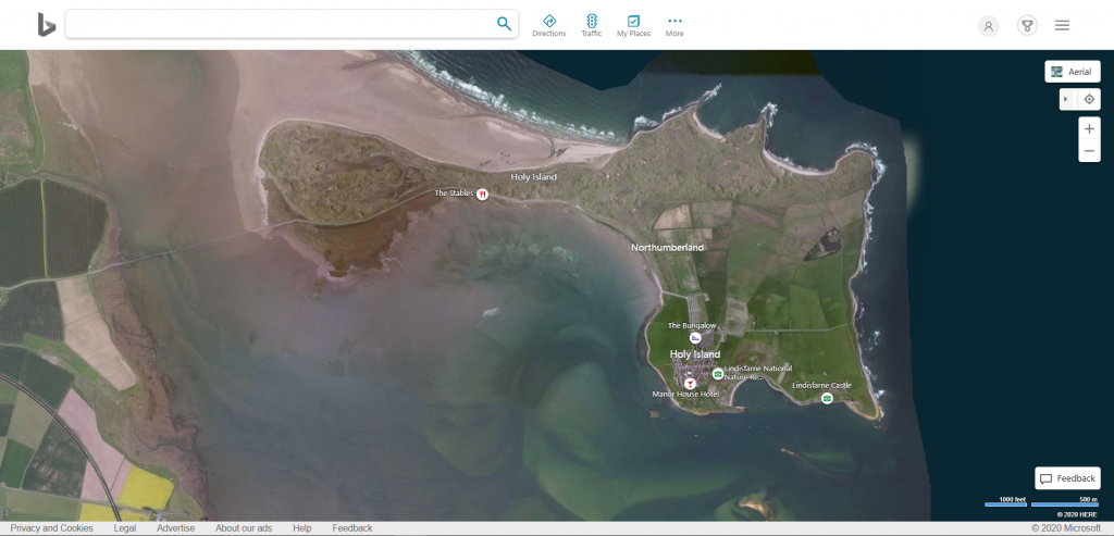
The aerial view is similar to Google Maps aerial view but comes from a different source, so is an alternative. Sometimes the aerial photography on one or other platform can be poor or masked by cloud. So, an alternative allows you to try a different one.
Street Map
Street Map is different to Bing and Google Maps. The first screen you see is for searching, unlike the previous mapping websites, that detect your location and zoom there automatically. However, once you are onto the map page you can pan and zoom like the others.
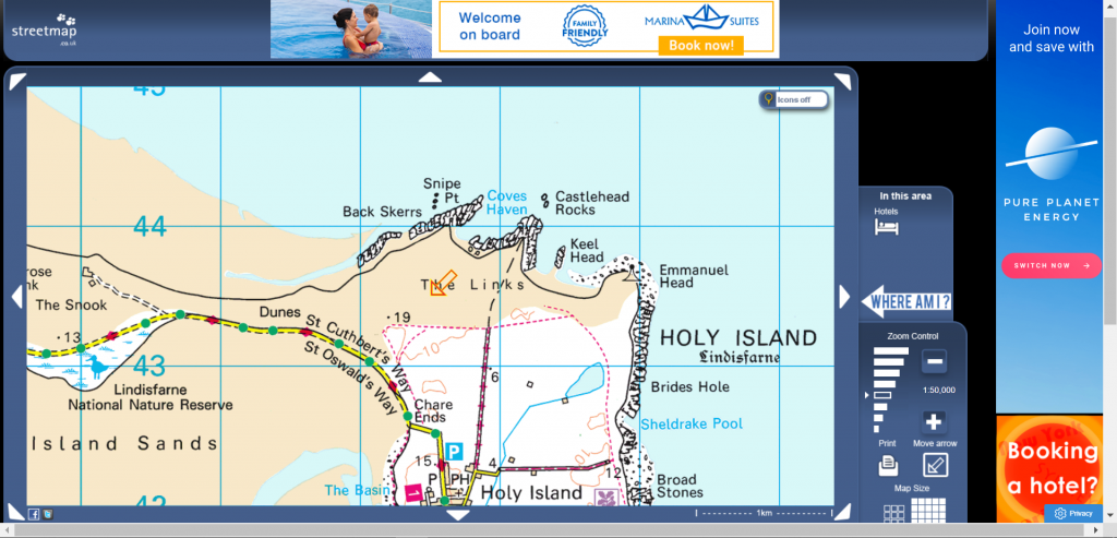
I use a Convert Coordinates feature to get accurate location coordinates and the nearest postcode. Just move the orange arrow to the place you want coordinates for and then click on the “Click here to convert coordinate” link below the map. A new page comes up with a bunch of useful coordinate information about that location. It even includes the “what3words” code.

Walk Highlands
Walk Highlands is a website that mainly focuses on exactly what it says, walking in the Highlands. However, if you set up an account, you can access a walk planning feature (the GPS menu tab) that has OS Maps.
I use this for planning walks and downloading a walk file that can be used in mapping software and GPS devices.

Researching
I find this bit as interesting as the planning bit, sometimes more. You can always learn something new and simply searching can lead you to discoveries that you weren’t even looking for.
You can research all kinds of things. A few ideas are place names, buildings, archaeology, geology, boundaries, railways and roads. There are plenty of useful websites, if you look hard enough for them. Here are a few ideas.
History
You can look at old photographs of where you are going at Francis Frith. I love old photographs. They not only show what things used to look like but what people did. Looking directly through a window to the past can be fascinating.

Old maps
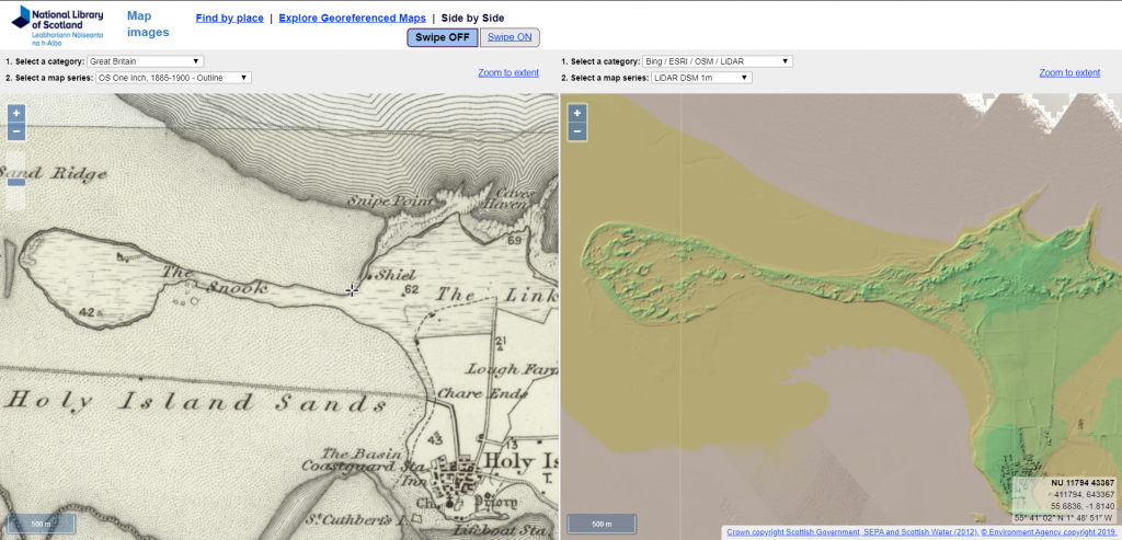
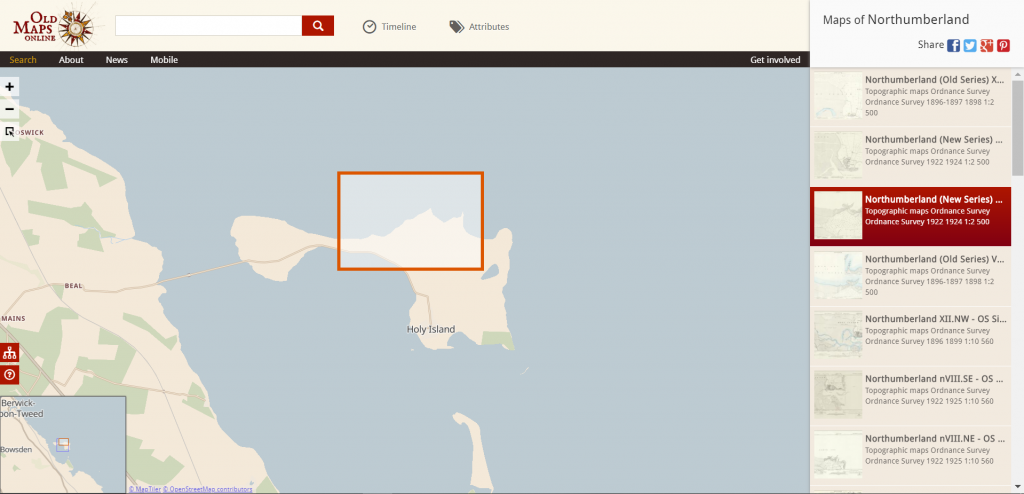
Old maps can give you a view of how things used to be. I recently became aware that whilst I had used the causeway to Holy Island many times, I did not know when it was built. I had just assumed that it had been there a significant amount of time. But, when I looked on an old map it wasn’t there. I looked on a later map and still not there. Later and later maps were looked at and still not there. I looked it up and was surprised that it had only been there since 1954. A new question came to me. How did they cross before 1954? This is how research continually leads to new questions. Old maps are often the way to find out more.
The National Library of Scotland has some great historic and geographical map resources, that are not just Scotland but the whole of the UK. There is an interesting resource that allows viewing of two different maps side by side. This also has some LIDAR imagery, which allows you to see under the surface and gives a different and interesting view of an area.
Old Maps Online allows you to select an area and then shows you what old maps are available for that area. Simply select the map and view it.
Geology
The British Geological Survey have a great online viewer, that gives you detailed information on surface and bedrock formations over the whole of the UK. A selection of basemaps can be used under the geology map. You can go to a location using name, postcode and even grid reference.

Place names
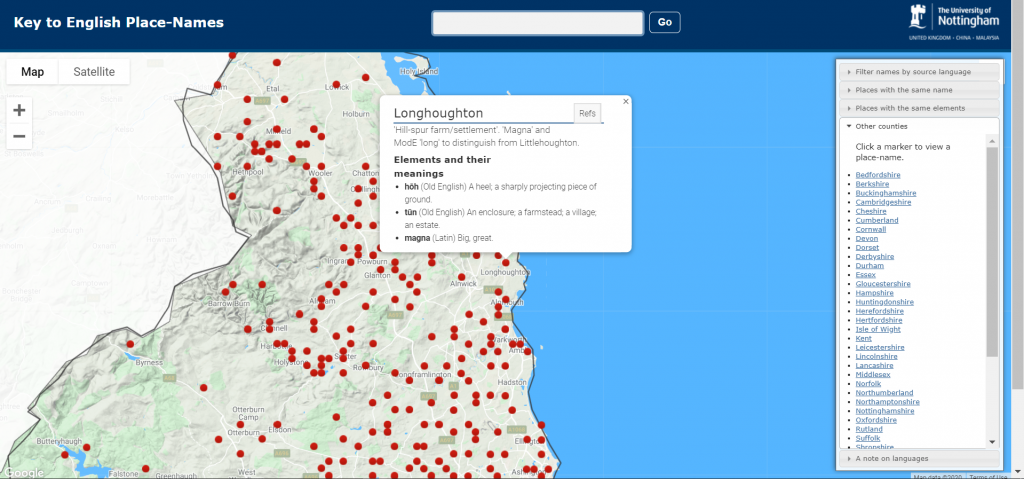
The University of Nottingham has a Key to English Place Names. It hasn’t got everywhere in but many places are. It gives you a full derivation of the name.
What else…
I could go on forever here but why not just go searching yourself. There is a huge free resource out there. You just might have to work to get what you want.
Enjoy walking and staying home, until it’s safe to get outdoors again.

I don’t even know how I ended up here, but I thought this post was great.
I don’t know who you are but certainly you’re going to a famous blogger if
you aren’t already 😉 Cheers!
Thank you very much.